Solutions
Close Solutions
Open Solutions
Instructional Formats
In-Person Instruction
Online Instruction
Hybrid Instruction
In-Person Instruction
Online Instruction
Hybrid Instruction
Science Kit Options
Build Your Own Kit
Ready to Ship Kits
Essentials Kits
How It Works
Build Your Own Kit
Ready to Ship Kits
Essentials Kits
How It Works
Carolina Online Gateway™
Platform
Carolina Complete
High School Program
Subjects
Close Subjects
Open Subjects
Anatomy & Physiology
Biology
Chemistry
Anatomy & Physiology
Biology
Chemistry
Environmental Science
Forensics
Geology
Environmental Science
Forensics
Geology
Health Sciences
Microbiology
Physics
Health Sciences
Microbiology
Physics
View All Subjects
Free Demo
Community
Close Community
Open Community
Carolina Distance Learning® Ambassadors Program
Certifications & Partners
Events & Webinars
Meet the Team
Partners for Science: PhET™ Simulations and Carolina Online Gateway
Carolina Distance Learning® Ambassadors Program
Certifications & Partners
Events & Webinars
Meet the Team
Partners for Science: PhET™ Simulations and Carolina Online Gateway
Events & Webinars
Partners for Science: PhET™ Simulations
and Carolina Online Gateway
Resources
Close Resources
Open Resources
Case Studies
Free Resources
Lab Notes by Carolina® Science Podcast
Safety Data Sheets
Testimonials
Why Carolina
Case Studies
Free Resources
Lab Notes by Carolina® Science Podcast
Safety Data Sheets
Testimonials
Why Carolina
Case Studies
Free Resources
Lab Notes by Carolina® Science Podcast
Safety Data Sheets
Testimonials
Why Carolina
Case Studies
Free Resources
Lab Notes by Carolina® Science Podcast
Safety Data Sheets
Testimonials
Why Carolina
Lab Notes by Carolina® Science Podcast
Why Carolina
Help Center
Close Help Center
Open Help Center
Contact Us
Frequently Asked Questions
Help for Instructors
Help for Students
Contact Us
Frequently Asked Questions
Help for Instructors
Help for Students
$
0.00
0
Cart
Modalities
Online Instruction
In-Person Instruction
Hybrid Instruction
Kit Options
Build Your Own Kit
Ready to Ship Kits
Essentials Kits
Solutions
Carolina HyFlex
High School Program
Online Gateway
Subjects
Anatomy & Physiology Kits
Biology Kits
Chemistry Kits
Environmental Science Kits
Forensics Kits
Geology Kits
Health Sciences Kits
Microbiology Kits
Physics Kits
Community
Carolina Distance Learning® Ambassadors Program
Certifications & Partners
Events & Webinars
Meet the Team
Partners for Science: PhET™ Simulations and Carolina Online Gateway
Resources
Case Studies
Free Resources
Lab Notes by Carolina® Science Podcast
Safety Data Sheets
Testimonials
Why Carolina
Help Center
Contact Us
Frequently Asked Questions
Help for Students
Help for Instructors
$
0.00
0
Cart
Back to Lab Selections
Rivers and Floods
Interpret topographic contour lines to measure gradients and relief; identify hills, basins, ridges, valleys, steep slopes, and gentle slopes.
Determine stream flow direction, gradient, and sinuosity from a topographic map.
Interpret stream valley profiles, and explain correlations between a stream’s characteristics and the shape of the valley it creates.
Identify and differentiate erosional and depositional landforms created by streams.
Use historical data (stream discharge) to calculate flood recurrence intervals and create a flood frequency graph.
View Materials
Rivers and Floods quantity
Add to Kit
Materials
Materials
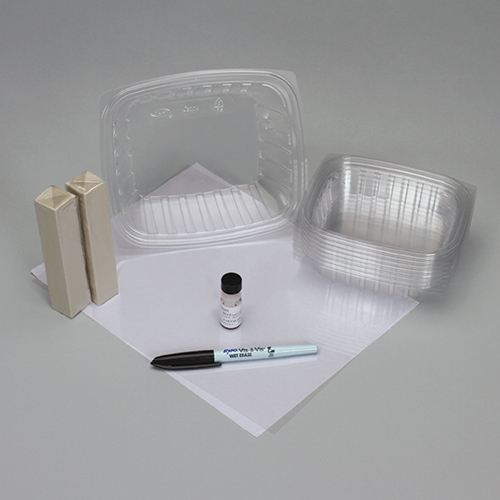
8 Plastic Containers, 8 oz
Plastic Container, 32 oz
2 Packages of Modeling Clay
Sheet of Transparency Film
Wet-Erase Marker
Food Coloring, Red
Plastic Cup, 10 oz
Ruler, 12”
Product has been added to your cart
Subscribe to Our Newsletter